

EVERYONE is familiar with maps of the Earth, but to most people a map of the sky is a mystery. Yet there are many similarities because the celestial cartographer faces the same problem as the terrestrial one: how to represent a curved surface on a flat sheet.
The earliest representations of the sky were actually globes, on which the constellations were shown as though viewed from a God-like position beyond the stars; this meant that the constellation shapes were represented back to front by comparison with the way we see them from Earth. In the Museo Archeologico Nazionale, Naples, is a marble statue of Atlas holding on his shoulders a globe of the heavens on which the constellations are depicted in this mirror-image way (see picture at right). The sculpture is called the Farnese Atlas, after Cardinal Alessandro Farnese who acquired it in 1562 and exhibited it in the Farnese Palace in Rome.
It is the oldest known celestial globe, for historians think that the sculpture was probably made in Rome during the second century AD. Even more significantly, it is thought to be a copy of a Greek original from the second century BC, not long after the time that Aratus wrote his poem the Phaenomena. Thus the globe held by the Farnese Atlas provides our only firsthand look at the star pictures that the ancient Greeks imagined in the sky.
Flat star charts
An early form of flat star chart was the astrolabe, popular with the medieval Arabs. Usually made of brass, the astrolabe was a disk on which the positions of bright stars were indicated; the same principle lives on in the star-finding devices called planispheres used by present-day amateur astronomers. The earliest surviving astrolabes date from the tenth century AD, but written evidence shows that they were known much earlier, possibly even in the time of Ptolemy, around AD 150. Astrolabes are a rich source of old star names.
Other than astrolabes, the oldest known flat sky map is a Chinese paper scroll, over 2 metres long, thought to date from the mid to late 7th century AD. It is known as the Dunhuang star chart after the place on the Silk Road trade route in north central China where it was found in the early 20th century; it is now in the British Library, London. Since the Dunhuang chart depicts the Chinese constellation tradition, which was independent of that in Europe and Arabia, most of the constellations are unrecognizable to modern eyes – see, for example, the north polar region of the sky in the box below.
The Chinese sky – a lost tradition
Chinese constellations were smaller than Western ones, and more numerous. Each constellation usually consisted of only a handful of stars which made it easier to specify areas of sky without the need for accurate coordinates. By the end of the third century AD, Chinese astronomers had developed an elaborate system of 283 constellations consisting of a total of 1,464 stars. These constellations did not depict myths but facets of Chinese imperial, social, and rural life.
For example, we find Dizuo, the throne of the emperor (the star Alpha Herculis); Huanzhe, the court eunuchs (60 Herculis and three neighbouring stars); Lingtai, the astronomical observatory; and even the toilet, Ce, behind a modesty screen, Ping, both in modern Lepus. In some parts of the sky, groups of constellations on a common theme formed large tableaux depicting scenes such as the autumn harvest, the winter hunt, a cavalry camp, and a celestial market. Some of the same characters popped up repeatedly in different parts of the sky, notably the Emperor and members of his extensive retinue.
THE FARNESE ATLAS

This 2m-high marble sculpture of Atlas from the second century AD shows him supporting a celestial globe engraved in bas-relief with the constellations known to the ancient Greeks. Unlike on later globes, no individual stars are shown, just the constellation figures. (Museo Archeologico Nazionale di Napoli)
THE DUNHUANG STAR CHART
Chinese constellations differed markedly from Western ones, being usually much smaller and incorporating fainter stars. This illustration shows the sky around the north celestial pole depicted on a chart dating from between AD 649 and 684 that was found in the early 20th century in caves at Dunhuang (pronounced dunn-hwong), China. Among the Chinese constellations shown on this view of the north polar region, only the familiar shape of the Plough or Big Dipper is easily recognizable to western eyes (lower centre). The Dunhuang manuscript is the oldest surviving star map in the world. Click on the image for a larger version. For more about the Chinese sky and Chinese star charts see here. (Image © British Library).

Unlike the imaginative artistry of western celestial cartography, Chinese star charts such as that from Dunhuang did not offer pictorial representations of these constellations. Instead, the chart makers simply plotted the constituent stars as dots of similar sizes connected by lines, with no attempt to scale the symbols according to the stars’ brightnesses. This lack of a magnitude scale on Chinese charts adds to the difficulty of identifying the stars involved. The Chinese constellation system was unknown in the West and had no influence on the 88 celestial figures that we know today. It was still in use when Jesuit missionaries introduced Western constellations to China in the 17th century, after which it died out. Information on Chinese constellations is included at the end of each constellation entry in Chapter 3.
Picturing the Ptolemaic constellations
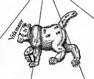
The earliest surviving depictions of the Ptolemaic constellations on paper are found in illuminated manuscripts of the poetic works of Aratus and Hyginus dating from the 9th century and onwards. These illustrations were the creation not of astronomers but of artists who interpreted the figures quite freely, with little concern for the framework of the underlying stars. As a result, the images bore only a loose resemblance to the constellation figures as described by Ptolemy. Woodcuts from later printed versions of these works, such as an edition of Hyginus’s Poeticon Astronomicon published in Venice in 1482, are sometimes reproduced in modern books as examples of early constellation visualization, but they are not true star charts. Their intent was simply to provide a decorative accompaniment to literary texts, with no pretensions to scientific accuracy.
It was actually the Arabs who produced the first scientific depictions of the Ptolemaic constellations, over 800 years after the Almagest was written. Around the year 964, an Arabic astronomer named Ἁbd al-Raḥmān al-Ṣūfī, usually known simply as al-Ṣūfī (or Azophi in Latinized form), produced a revised and updated version of the star catalogue in the Almagest called the Book of the Fixed Stars. Al-Ṣūfī added charts of each constellation, something that the Almagest lacked. As well as accurately plotting the stars, al-Ṣūfī gave life to the constellations by drawing in the various figures. However, the imagery was adapted for Arabic culture: the human characters were clad in Arabic robes, not Greek ones, and there are other aspects of the iconography, such as the design of the ship Argo, that look unfamiliar to western eyes. So to find the true genesis of present-day star charts we must look back to Europe.
First printed star chart
A major step towards standardization of imagery of the Greek constellations came in 1515 when Albrecht Dürer, the great German artist, drew the first European printed chart of the heavens with the help of Johannes Stabius, an Austrian mathematician, and Conrad Heinfogel, a German astronomer. Dürer’s chart consisted of a pair of woodcuts, one showing the zodiac and all constellations north of it, the other showing all known constellations south of the zodiac. Both halves are based on the stars and constellations catalogued by Ptolemy in his Almagest, updated and accurately plotted for the year 1500. The constellations are in mirror image, as on a celestial globe or an astrolabe, a tradition that most early maps were to follow.
Dürer’s depictions of the constellation figures established an artistic style that was echoed on many later celestial maps, the most outstanding example being the magnificent planisphere in the Astronomicum Caesarum of 1540 by another German, Peter Apian (1495–1552), known as Petrus Apianus in Latin. The Dürer style, too, was superseded by a sequence of four great star atlases that in turn set new standards, both scientific and artistic.
© Ian Ridpath. All rights reserved
NEXT ►